|

NOVITA'


MD MILITARE

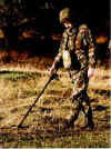
cerca
servizi cerca cavi tubi
checkpoint
porta metalcerca servizi

termo camera

AUDIO HI-FI
Amplificatori
a valvole

Diffusori
acustici
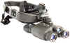 Visori
mirini notturni ottiche
Visori
mirini notturni ottiche

Strumenti
elettronici bonifica ambientale

contatori
geiger

API
COLTURA
 MONTAGGIO COMPO
NENTI
MONTAGGIO COMPO
NENTI
 Costruzioni
meccaniche modellismo a vapore giochi di latta
Costruzioni
meccaniche modellismo a vapore giochi di latta
radio
LA
STORIA
CONTATTI
ORDINI
| |
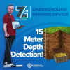
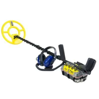
METAL DETECTOR JEOHUNTER,
JEOHUNTER RADAR GPR, JEOHUNTER GEOPHISYCAL SYSTEMS
jeohunter europe
makrodetector www.makrodedektor.eu

*
The two-dimensional imaging technology has never attained this high a level.
* A model with superior features that will always be mentioned with its imprints
and impacts on the two-dimensional detector technology!
* 2D imaging technology has changed dimensions with it!
* It is pretty practical in searching targets, it is strong in obtaining results
and it is clear and sure in decision-making!

Electronics company practices
a promotional policy to offer the products to the consumer with sensitivity
and care through extraordinary promotions that are different from the
customary methods.
With the transparent promotional policy adopted by Electronics company,
the company has been informing the consumers about all the features of the
products, principles of operation and details. Thus, while the consumer gains
information about the product on one hand, he will see and get informed about
how the system works, how the settings are made, how the system detects the
targets and sorts them, with types images and data the system communicates
them to the user and all the relevant stages in steps.
With the opinion that this promotional method implemented is the best
method that should be implemented and any other promotional methods result in
the consumer being unable to access enough information especially in the
detector sector and for the detector products or in the violation of consumer
rights making the consumer settle for incomplete information that is not
revealing, Electronics company has developed the current
transparent product promotion policy.
Jeohunter is a top model in our product range, which has high
detector
technology used for it and also superior features.
Some of the features and equipment constituting the main features of
Jeohunter are provided below.
*Artificial Intelligence Algorithms
*Real Time 2D Imaging
*Images equivalent to GPRS Technologies
*Imaging the Target Forms From Above
*Reporting Target Diameter and Depths
*High Accuracy in Sorting Metals
*Ground Definition and Automatic Setting
*Proportioning the Target Intensity by Percentages
*Data Library
*Digital Signal and High Resolution
*Highly Conductive Signal
*Detection and Identification in Depths
*Real Time Data Transmission
*A unit that thinks and interprets
*Preventing False Alarms
*High Accuracy in Transmitting Data
*Perfect Communication and Operation
*Monitor that does not require a laptop
Large Colour Screen and Animations
while turning on
Jeoscan turns the system data and images into a feast of images with all
the details in high resolution due to the large and colour screen it has. All
the user has to do in order to enjoy this feast is to turn the ON/OFF switch
from "off" to "LCD". After it is switched to LCD, the
animated images are formed on the screen with a high speed. 5 seconds later,
Jeoscan logo is seen on the screen. The logo remains on the screen for
approximately 3 seconds.

Search Antenna Scan and Antenna
Failure Feature
Jeoscan performs a fast and reliable data scan for possible user errors
or applications left incomplete due to its high technology. For example, if
the antenna socket is not fully connected to the system input at the antenna
connection site, if there is lack of connection or if there is any problem
such as a failure etc. in signal transmission, the system detects it
immediately and informs the user about the problem as seen in the images.
Otherwise, the user will carry out searches in vain with a detector that is
not operable, which the user thinks is operable and sending signals, and
more importantly the user will be unable to detect any targets that are
actually in that zone or area and will maybe even lose the chance of the
biggest finding of his life. Thus, it is beyond dispute that such an alarm
system is vital in this respect.

Ground Definition and Automatic
Ground Setting
Jeoscan enables easy settings scanning
the ground structure comfortably even under the most difficult conditions.
It provides information by showing the ground data on the screen and then
there is no need to make another ground setting for the same or similar
ground environments. As may be seen in the images, if the operations
necessary for the ground have not been performed or if a search is taking
place assuming such settings have been made, then the signal will not
penetrate or will be penetrating very poorly into the ground. The first
image shows the display with no or insufficient setting. Then, as may be
seen until image 5 in an order, the signal sent from the antenna will
penetrate into the ground as the ground effect is made up for.
The said ground setting may be providedeasily in a  few
steps with the + and - buttons in the Jeoscan and as it is few
steps with the + and - buttons in the Jeoscan and as it is
possible to observe whether the signal penetrates into the soil or not,
the risk of searches with signals not penetrating into the ground is
eliminated. The final operation of the ground setting made will be taken as
the reference by the system and the ground effect is quantified in the
display; so an opportunity is provided for automatic scanning with no need
for the user to enter another ground setting for the same ground structure
the next time..
 
Note: Before entering
any ground settings or at any position, the user may increase or decrease
the "accuracy - sound - display light" settings or may benefit
from the option to perform a search without seeing the invaluable metals by
using the option of accepting and refusing the invaluable metals. What
should be done for this purpose is to enter the settings by pressing the
settings button on the system board and confirming with - or + buttons. Then
the confirmation button is pressed and the general search mode with metal
sorting is passed.

High Accuracy and Target Creation in
Sorting Metals
Jeoscan compares the signals from many different
systems known up to now in detecting the spaces for detecting and sorting
metals and reads the signature spectrum for the targets in signal structure
and conveys the data related to the target in the most accurate manner.
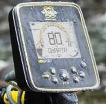
Jeoscan creates the target form and has linear
bars showing the data for 4 targets at the same time by percentages in a
single display. Thanks to this feature, different metals and space and the
gold and valuable metals in space can be detected and also percentage data
is shown related to the target quantity by proportioning. The images show
the formations, target types and proportions related to the fund targets.

If we clarify what the oscilloscope displays in the images mean, we will
understand the importance of the oscilloscope displays better.
When paid attention, there is a white reference line extending
horizontally just in the middle of the oscilloscope window and another red
line showing the target effects. If the red line is below the reference
line, it means that there is a space. If it is formed on the line, it means
that this is a metal and the drawings for both the space and metals give the
view of the target from above.
The valuable-invaluable space percentages above the linear bars, on the
hand, give the results of these images for the width and intensity effects.
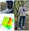
Real Time 2D Images Equivalent
to GPR Technology
As known, it is impossible to obtain real-time 2D images in many of the
technologies known as ground penetrating radar systems. Moreover, it is
impossible to sort metals.
Jeoscan makes real time detections and immediately creates images of
these detections. Thanks to this report, the target types and proportions
are also communicated in it in addition to the target dimensions.
In order to receive a 2D image report, the user needs to press the scan
button on the detected target and attach the search antenna. Upon exit from
the target, the analysis report with 2D image will be displayed as soon as
the scan button is released. Analysis reports regarding different targets
are given in the images.

To make an explanation though the images and reports clearly reveal the
results, red means metal; orange, yellow and blue shades on the edges of the
metal, on the other hand, show the magnetic field and spaces around the
target. For example, the first image shows the target being metal and gold,
the other image shows space by 80% and valuable metal by 15% with it, the
other image shows invaluable metal by 13% with a second valuable metal
accompanying it by 66%, the analysis with blue image shows the space and the
one next to it shows valuable target by 90% in space.
Image Reporting of Target Diameter and Depths
Jeoscan detects the diameter, size and depth of the targets in a
surprisingly accurate manner and performs an operation that can is described
as difficult and impossible by presenting a report with all the details and
images

to create a target depth report with image,
the user should get the antenna close to the starting points of the target
signal from four sides of the detected target and should mark the signal
starts on the ground; and then should save the data relating to the width and
length of the target that appears in the depth window, which appears when the
depth button is pressed; the next operation when saving is done is to press
the scan button, getting the search antenna up to the end of the signal over
the target. At the end of the target, when the scan button is released, the
relevant analysis report will be displayed on the screen in real time.
The images show some of the screen shots from the help video file in the
system related to the analysis reports for various target depths and sizes and
also related to how to measure the target diameters.

The images show some of the screen shots
from the help video file in the system related to the analysis reports for
various target depths and sizes and also related to how to measure the target
diameters.


We hope that we have been able to provide sufficient information by the
above and we have been able to help you get informed. For your further
inquiries and requests, our sales staff and managers serve you selflessly to
help you gain information.
send us your inquire, to info@bravodog.com
o admin@wilsonelectronics.info for
more informations and pricing
ASK
SPECIAL PRICES
X JEOHUNTER
email
mediaelettra@mediaelettra.com
GEORADAR system
12
 
|
to cliccare on
the photos in order to magnify them
|
There Georadar system 12, portable, of new
generation and elevated technology, centers it them radar e' the directly
interfacciata to notebook pentium with display to colors, in order to see what
e' in sottosuolo and relative stratografia to colors. Georadar system the 12 e'
indispensable for taken care of continuous and not destructive surveyings and
superficial visions and of the sottosuolo. For the searches they are not demands
diggings, not you e' risk to interrupt lines or pipages and are not necessary
cables to spread; only an antenna to pass on the land. The indispensable
Georadar e' for multiple applications: localization and optimization of
archaeological diggings, survey of I placed and buried objects, mines and
tunnel, controls of street paving, profiles of the sottosuolo, search of
stratums, fractures to you and cavita', glaciologia, survey pipages and cables
and areas sottosuolo contaminated. Used also in civil engineering for searches
of smottamenti and control of bridges, palaces and constructions in c.a.,
diggings prefoundations, ect
 
Technical characteristics: data visualize to
you in real Time on the display of the PC, Time range from 50 to 2000 nanosec,
transmit range: 115 KHz, adjustable gain, filters: verticall/horizontal low and
higt-pass filter, matched filter, inverse filter, migration filter, envelope
filter, median filter, ect. transfer given via rs-232C, feeding 12V Dc,
consumption 0,7 Ampere. Weight 3Kg. Elevated precision and resolution from first
cm. until 30 mt. of the sottosuolo with the aid of the following antennas:
unita' 2000 Mhz dimensions 27x13x13 cm and 1,5
weight Kg, of maximum precision until 2mt, unita' 900 MHz dimensions 43x22x2,
weight 2 kg, for profondita' until 5 mt. unita' to 500 MHz dim. 69x32x3 and
weight 4 kg for prospectings until 10mt, unita' 300 MHz dim. 98x52x4, weight 10
kg for prospectings until 15 mt, unita' to dipole in air from 150 MHz fine
weight 6 kg for prospectings until 30 mt. The equipment radar composed standard
e' gives: it centers them operating radar, notebook with the special software
and operating handbook of management in English language, probe from 2000
interchanging MHz, battery and cables of connection.
 
Example of prospecting of three tubes buried in
the sottosuolo to one profondita' of approximately 1,2 mt. Every tube generates
marks having them the hyperbolic shape, to which appendix corresponds the exact
lease of the tube. The survey e' be executed with the antenna of sensibilita'
from 2000 MHz. And prospecting of ghiacciai. It encloses you to the equipment
radar are added to photo examples prospectings and surveys accompanied from
explanations. The equipment radars and relati software to you is always in
continuous development, for further information not hesitated to contact to us.
EURO 15400 while for the chartering e' available to 775 for 15 days.
| |

LA
LEGGE
GEORADAR
Z18
GEORADAR
IMAGER
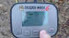
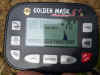
GOLDEN GM6
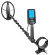
3D METAL DETECTOR VISIONARY
EVO6000
DETECTOR GRAFICO
GAUSS MARS MD

GARRETT APEX

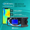
GM ONE

DEEP HUNTER
blisstool LTC64X 
apolonia gold
rutus argo
rutus alter 71
gm5+ se

detectorpro 12DD sub
30mt
tdi beach hunter sub
garrett at max

viking vk40 240
whites mx7
mini detector 210
340 golden mask 4wd
white's mx
sport sub
pulse hunter 8 metri da
profondita
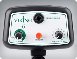
Viking 6 euro 120 nomotion
garrett 200i
300i 400i
white's treasure master

jeohunter
|


